480.628.1128 homes@brittanyfanelli.com Instagram @brittanyfanelli_homes
Schedule a consultation

Moving to the East Valley, ArizonaSunshine, saguaros and room to breathe.


Desert trails close to home, lakes tucked into the canyons, pine country a drive away and long, mild winters. This is my guide to moving to the East Valley, dated and sourced: the places worth knowing, realistic drive times, the seasons and the practical details I check for every client.

Why the East Valley

Desert, lakes and mountains, within reach


The East Valley is the southeast side of metro Phoenix: Mesa, Gilbert, Chandler, Queen Creek, San Tan Valley and Apache Junction, with the SanTan, Usery and Superstition mountains on the horizon. I was raised in Mesa and still live here, and I'd love to show you what daily life is really like, from the long, mild winters to the summers you plan around.

The East Valley at a glance
The East Valley at a glanceThe details
Cities and townsMesa (513,656), Gilbert (287,285), Chandler (278,748) and Queen Creek (89,770), per U.S. Census Bureau estimates for July 1, 2025. San Tan Valley became a town in September 2025, after that estimate was made.
CountiesMaricopa County, plus Pinal County for San Tan Valley and part of Queen Creek
AirportsMesa Gateway Airport, about 6 road miles from Queen Creek Town Hall, and Phoenix Sky Harbor, about 31 to 35 road miles west
ClocksMountain Standard Time all year. Most of Arizona doesn't observe daylight saving time.

How I measured: road miles and drive times on this page are estimates without traffic from OpenStreetMap routing, run October 14, 2026, from Queen Creek Town Hall and from points in East Mesa. Rush hour, weekends and weather add time. Fees, hours and closures were checked on the same day and change often, so confirm before you go.

By the numbers · Updated October 2026

Sun, seasons and growth


Sun and seasons

  • 85%Of possible sunshine, yearly averageNOAA, Phoenix records 1965–1983
  • 211Clear days a year, plus 85 partly cloudyNOAA Comparative Climatic Data, Phoenix, checked Oct 14, 2026
  • 67.6°FAverage high in JanuaryNOAA 1991–2020 normals, Phoenix Sky Harbor
  • 111Days a year at 100°F or hotterNOAA 1991–2020 normals, Phoenix Sky Harbor

Moving and growth

  • 235,000Moved to Arizona from another state in 2024 (estimate)U.S. Census Bureau, ACS 2024, released Jan 2026
  • 52,400Of those, from California, about 22% (estimate)U.S. Census Bureau, ACS 2024, released Jan 2026
  • 8.2%Queen Creek's growth in one year, to 89,770U.S. Census Bureau, July 1, 2025 estimate
  • 4.6%Pinal County's growth in one year, to 539,380U.S. Census Bureau, July 1, 2025 estimate

What it means

Sunny, mild winters are the draw, and the summers are the trade-off, which is why this page is honest about both. Growth is strongest at the Valley's southeastern edge: Queen Creek and Pinal County added people quickly, while Mesa held steady at 513,656 (down 0.2%, U.S. Census Bureau, July 2025). Washington, Texas, Colorado and Illinois followed California as the largest sources of movers to Arizona in 2024.

Climate figures are for Phoenix Sky Harbor, the official Valley weather station, so East Valley conditions are similar but not identical. Migration figures are survey estimates with margins of error.

Hikes & trails

Desert trails, close to home


Two Maricopa County regional parks are each about 7 road miles away: San Tan Mountain from Queen Creek and Usery Mountain from East Mesa. The Superstition Mountains rise a little farther east, and Gilbert and Chandler add shaded preserves and canal paths in town.

Trail season here runs opposite to most of the country. The cooler months, roughly late October through April, are prime hiking time, and summer hikes are finished early in the morning.

Maricopa County regional parks charge $10 per vehicle per day. The county's annual day-use pass is $120 and rises to $140 on January 1, 2027 (Maricopa County Parks, checked Oct 14, 2026).

Close to home


County parks, town trails and city preserves within about 20 minutes of Queen Creek or East Mesa.

Queen Creek · about 18 minutes

San Tan Mountain Regional Park

More than 10,000 acres of lower Sonoran Desert on the Queen Creek and San Tan Valley edge, rising from about 1,400 to over 2,500 feet. Nine named trails, about 20 miles in all, are open to hiking, biking and horseback riding, from the easy Littleleaf (0.7 mile) and Stargazer (0.8 mile) to the 6.4-mile San Tan loop. The nature center has a tortoise habitat.

About 7.5 road miles from Queen Creek Town Hall and 18 from East Mesa. $10 per vehicle per day. Open 6 a.m.–8 p.m. November through April and 5 a.m.–9 p.m. May through October.

Maricopa County Parks, checked Oct 14, 2026
Northeast Mesa · about 12 minutes

Usery Mountain Regional Park

3,648 acres with more than 30 miles of trails. The Wind Cave Trail climbs 812 feet in 1.5 miles (one way) to an alcove where water seeping from the rock feeds hanging gardens of rock daisy; it's rated difficult and open to hikers only. The 0.9-mile Merkle Trail is accessible and carries the county's easiest rating, and the Pass Mountain loop runs about 7.1 to 7.5 miles by the county's figures.

About 7 road miles from East Mesa and 18 from Queen Creek. $10 per vehicle per day. The county notes that difficult trails become "extremely difficult" above 90°F.

Maricopa County Parks, checked Oct 14, 2026
Tonto National Forest · about 16 minutes

Hawes Trail System

A network of Forest Service trails at Mesa's northeast edge, used mostly for mountain biking and shared with hikers. A 2022 project added a parking lot on the west side of Usery Pass. Trail guides that credit the volunteer Hawes Trail Alliance count about 60 miles across more than 30 trails; that figure isn't from an official source.

About 9 road miles from East Mesa. Exposed desert with no water, so ride or hike early and carry plenty. Check the trailhead kiosk for the current map.

USDA Forest Service and Hike Arizona, checked Oct 14, 2026
Queen Creek · in town

Queen Creek's wash trails

Multi-use trails follow two desert washes, a nod to the town's farming and equestrian roots. The town lists the Queen Creek Wash Trail at about six miles, with parking at Mansel Carter Oasis Park and Desert Mountain Park. The Sonoqui Wash Trail starts at Horseshoe Park & Equestrian Centre and runs through rural desert, open to walkers and riders.

No fee. The town lists the Sonoqui at 3.8 miles, and TrailLink lists 5.8 after recent extensions. There's little shade, so walk or ride at sunrise in summer.

Town of Queen Creek and TrailLink, checked Oct 14, 2026
Queen Creek · Riggs Road

Horseshoe Park & Equestrian Centre

The town's equestrian center hosts English and Western riding events and the spring Roots N' Boots rodeo. Its Community Arena, with a round pen and restrooms, is open for drop-in riding, and 1.3 miles of trails opened here on a former landfill site.

About 2.4 road miles from Queen Creek Town Hall. Drop-in riding in the Community Arena runs 7 a.m.–10 p.m. daily; barrels and jump poles aren't allowed. Reservable RV spaces with hookups.

Town of Queen Creek and Queen Creek Independent, checked Oct 14, 2026
Chandler · Gilbert · Mesa

Canal paths and city trails

Chandler's Paseo Trail runs 6.5 miles along the Consolidated Canal, with a 10-foot concrete path on the east bank and an unpaved west bank used for horseback riding and biking. Discover Gilbert counts about 135 miles in Gilbert's trail system, including equestrian tracks, with more than 54 miles of marked bike trails along the canals and pocket parks with shade and drinking fountains.

No fee. Chandler doesn't allow motorized vehicles, e-bikes included, on its parks and trails. Stay out of canal water, and use paved paths early on summer days, when they heat up fast.

City of Chandler and Discover Gilbert, checked Oct 14, 2026
Gilbert · about 13 minutes from East Mesa

Riparian Preserve at Water Ranch

A 110-acre preserve with seven ponds and more than 4.5 miles of trails through plantings that range from marsh to desert. The National Audubon Society has named it an Important Bird Area, and it also has an ethnobotanical garden and a community fishing lake.

About 8.4 road miles from East Mesa and 13 from Queen Creek. The town lists preserve hours of 5:30 a.m.–10 p.m., with trails open dawn to dusk, and I found no entry fee listed. Go at dawn in summer.

Town of Gilbert and Discover Gilbert, checked Oct 14, 2026
Chandler · about 16 minutes from Queen Creek

Veterans Oasis Park

A 113-acre city park, 78 acres of it groundwater recharge basins and wetlands. It has 4.5 miles of groomed dirt trails, a 0.4-mile paved path around a 5-acre fishing lake, and designated equestrian trails. The city says more than 153 bird species have been documented here, and the Chandler Nature Center is next door.

About 8.6 road miles from Queen Creek and 17 from East Mesa. Open 6 a.m.–10:30 p.m. Desert Rivers Audubon leads bird walks the first Saturday of each month, November through April, 8–11 a.m.

City of Chandler, checked Oct 14, 2026
Gilbert · Mesa · Apache Junction

Stargazing nights

The East Valley Astronomy Club runs the Gilbert Rotary Centennial Observatory at the Riparian Preserve, with a 16-inch telescope and public viewing on Friday and Saturday evenings from sunset to 9:30 p.m., weather permitting. Lost Dutchman State Park holds monthly star parties October through March.

The observatory suggests a donation of $5 per family or $3 per adult; check the club's schedule for viewing nights. Lost Dutchman star parties need registration plus park entry. Usery Mountain's ranger stargazing program is Thursday, October 29, 2026 (registration required, limit 20).

East Valley Astronomy Club, Arizona State Parks and Maricopa County Parks, checked Oct 14, 2026

Worth the drive


The Superstition Mountains and the desert east of the Valley, from about 25 minutes to about an hour from East Mesa.

Apache Junction · about 24 minutes from East Mesa

Lost Dutchman State Park

At the foot of the Superstition Mountains. The Treasure Loop is 2.4 miles round trip with a 500-foot elevation change, Siphon Draw runs about 4 miles round trip into a canyon, and the Native Plant Trail is accessible. The Flatiron route beyond Siphon Draw is steep, hard to follow and not maintained all the way, and the park says to allow at least five hours.

About 14 road miles from East Mesa and 24 from Queen Creek. $10 for a vehicle with one person, $20 with two to four. Trails open 6 a.m.–8 p.m. The park doesn't recommend Siphon Draw in hot weather and says to carry at least a gallon of water per person per day in summer.

Arizona State Parks and USDA Forest Service, checked Oct 14, 2026
Superstition Wilderness · about an hour from East Mesa

Peralta Trail to Fremont Saddle

The Forest Service calls Peralta "one of the more heavily used trails in Arizona." Most hikers go as far as Fremont Saddle, about 2.2 to 2.4 miles one way with roughly 1,400 to 1,500 feet of climbing, according to third-party trail guides, for the well-known view of Weavers Needle. The footing is often bare bedrock.

About 20.5 road miles from East Mesa and 30 from Queen Creek; the last 8 miles are on Peralta Road (Forest Road 77). No fee and no drinking water, and the Forest Service says the trailhead restrooms are closed for now. There's no shade on the route, so treat it as a cool-season or early-morning hike.

USDA Forest Service (Tonto National Forest), Hike Arizona and Outdoor Project, checked Oct 14, 2026
Gold Canyon · off US 60

Hieroglyphic Trail

The Forest Service describes it as a relatively easy out-and-back route, 1.1 miles each way, from the Cloudview Trailhead, at the Superstition Wilderness boundary. Trail guides say it ends at a canyon with Hohokam-era petroglyphs and seasonal pools that depend on rainfall. Petroglyphs are protected cultural resources: look, but please don't touch.

Parking at Cloudview Trailhead is very limited and fills quickly. The Forest Service says to use the Lost Goldmine East Trailhead if it's full and to obey no-parking signs. No fee listed. The route is exposed, so go early and carry water.

USDA Forest Service and Arizona Highways, checked Oct 14, 2026
Near Superior · about 42 minutes from East Mesa

Boyce Thompson Arboretum

A desert botanical garden east of the Valley. Its Wallace Desert Garden alone covers 13 acres with 1.5 miles of trails, and docents lead golf-cart tours on Thursdays, 9:30–10:30 a.m., from October 2026 through April 2027. The Fall Plant Sale runs October 17 through November 1, 2026.

About 32 road miles from East Mesa and 42 from Queen Creek, via US 60. Open 8 a.m.–5 p.m. daily October through March, with early-morning hours in summer. Admission is $24.95 for ages 13 and up ($16 in summer), $10 for ages 5–12 and no charge under 5. Leashed pets welcome.

Boyce Thompson Arboretum, checked Oct 14, 2026

Hiking in the heat, honestly

In the Phoenix area, the average first 100°F day is May 2 and the average last is October 5 (NWS Phoenix, 1991–2020 normals). Maricopa County's trail guidance is worth keeping in mind all summer:

  • Trails rate at least one level harder in hot months, and difficult trails become "extremely difficult" above 90°F.
  • Carry enough water for the whole hike, pets included, and turn around when half of it is gone.
  • Plan on about 1 to 1.5 miles an hour on most trails, and tell someone your plans.
Maricopa County Parks trail ratings and NWS Phoenix, checked Oct 14, 2026
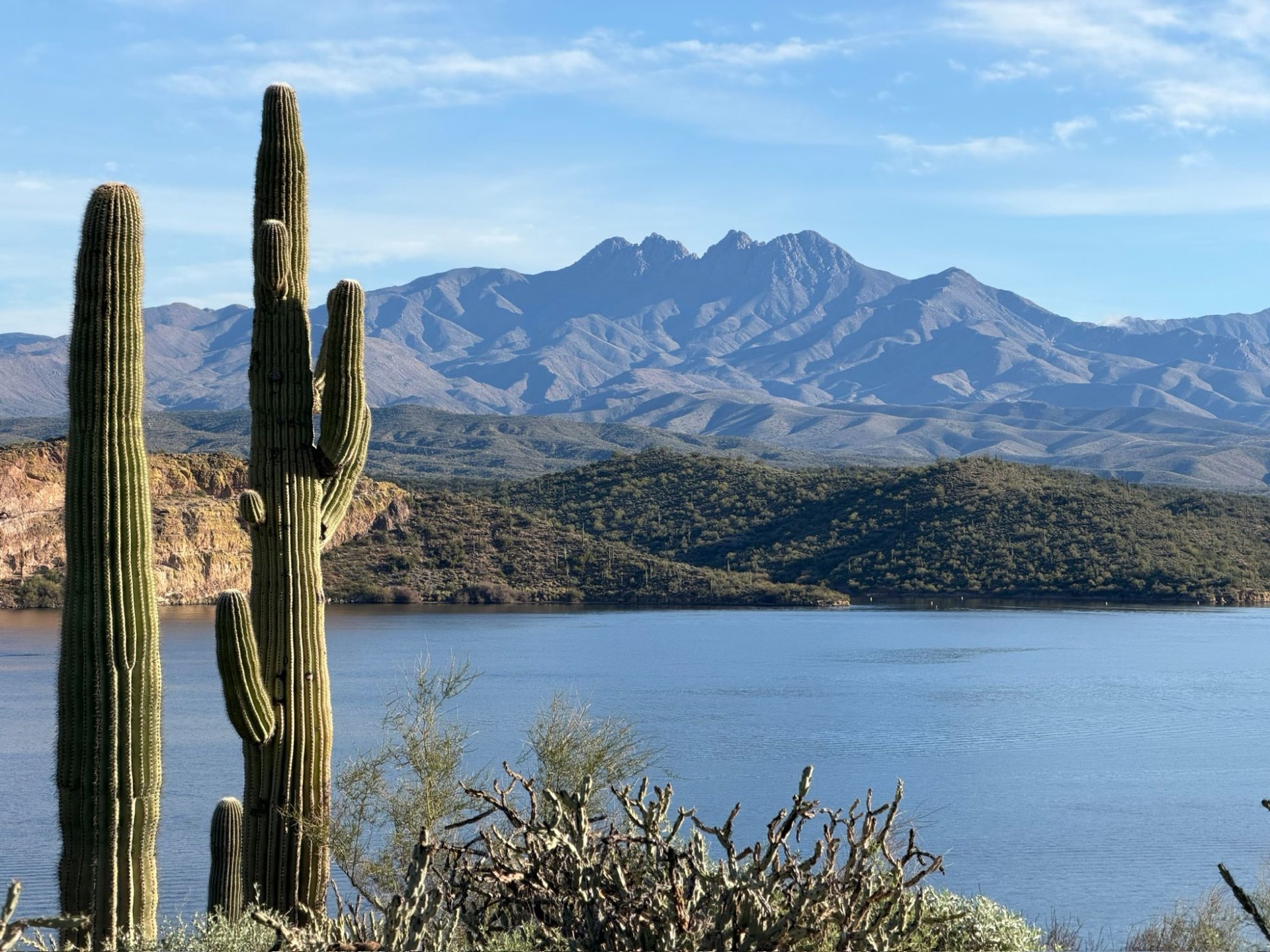
Saguaros above a desert lake, with mountains beyond
Lakes, fishing & lake days

Lakes in the desert canyons


Northeast of Mesa, the Salt River runs through a chain of reservoirs in the Tonto National Forest: Saguaro, Canyon, Apache and Theodore Roosevelt lakes, with Bartlett Lake on the Verde River to the north. Saguaro Lake is about 30 minutes from East Mesa. Closer to home, Arizona Game and Fish stocks community fishing lakes in city parks in Mesa, Gilbert, Chandler and Queen Creek.

Timing matters this fall. Canyon Lake has been closed since September 8, 2026 for dam-safety maintenance and is expected to reopen in early 2027, and the 2026 river tubing season has ended (Tonto National Forest, SRP and Salt River Tubing, checked Oct 14, 2026).

On the lakes and the river


From Saguaro Lake, about half an hour away, to the long canyon lakes that make a weekend. Most sites in the Tonto National Forest take a Tonto Pass; the details are below the cards.

Tonto National Forest · about 30 minutes

Saguaro Lake

A desert reservoir behind Stewart Mountain Dam, at about 1,500 feet, set among canyon walls and saguaros. Visit Mesa describes it as about 10 miles long with 22 miles of shoreline. The Forest Service lists waterskiing, boating, swimming, fishing and picnicking, and Saguaro Lake Marina rents pontoons, tritoons and deck boats and has the Lakeshore Landing restaurant.

About 17 road miles from East Mesa and 28 from Queen Creek. The Forest Service says the lake reaches capacity on most weekends and holidays from April to October, and vehicles towing boats are turned away once boat parking is full, so arrive early.

USDA Forest Service, Visit Mesa and Saguaro Lake Marina, checked Oct 14, 2026
Saguaro Lake · scenic cruises

Desert Belle cruises

An 80-minute narrated cruise on Saguaro Lake covering desert history, geology and wildlife, with a Coast Guard-certified captain. Visit Mesa says the boat has cruised the lake since the 1960s, and the operator lists live music on weekends, craft beer cruises on Friday evenings and wine cruises on Wednesdays.

Book through the operator's website. Visit Mesa notes that fall through spring is generally the most comfortable season for tours.

Desert Belle Cruises and Visit Mesa, checked Oct 14, 2026
Saguaro Lake · about 40 minutes

Butcher Jones Beach and Trail

A day-use site with a gently sloping beach and mesquite-shaded picnic sites, used for swimming and rafting. The bay in front of the beach is closed to motorized boats. The Butcher Jones Trail, about 5 miles out and back by the Forest Service's count, starts at the east end of the parking lot and follows the shoreline past Peregrine Point to a lake overlook.

About 20 road miles from East Mesa and 31 from Queen Creek. No lifeguards, food vendors or glass. Visit Mesa says the lot fills fast on spring and summer weekends and suggests weekdays, or arriving before 9 a.m. in summer.

Visit Mesa and USDA Forest Service, checked Oct 14, 2026
Closed for dam maintenance · expected back early 2027

Canyon Lake and the Dolly Steamboat

Canyon Lake normally winds between red rock cliffs, with a floating fishing pier, swim and picnic areas, and a quieter east end where bighorn sheep are sometimes seen. It closed on September 8, 2026 while SRP and the Bureau of Reclamation lower it about 54 feet to inspect and maintain two dams, work done about once every 20 years (last in 2007).

SRP's roughly 16-week schedule and the Dolly Steamboat's own notice point to early January 2027, and SRP says the inspections could extend the timeline. The Dolly's cruises are paused until the lake reopens. About 22 road miles from East Mesa via SR 88.

Tonto National Forest, SRP and Dolly Steamboat, checked Oct 14, 2026
Bush Highway · about 20 to 27 minutes

The Lower Salt River

Below Saguaro Lake, the river runs past Forest Service day-use sites used for tubing and kayaking in season. Raccoon Bluff (often called Coon Bluff) is a mesquite-shaded river site the Forest Service calls outstanding for bird watching. The Salt River horses are often seen along the river; they're protected by state law (A.R.S. 3-1491), and Visit Mesa advises staying at least 50 feet away.

About 11 to 14 road miles from East Mesa and 22 to 25 from Queen Creek. Salt River Tubing's 2026 season ran April 25 through the end of September. No glass, and the Forest Service warns that fallen trees in the river can trap floaters.

USDA Forest Service, Arizona Legislature, Visit Mesa and Salt River Tubing, checked Oct 14, 2026
Tempe · about 30 minutes

Tempe Town Lake

An urban lake of more than two miles with a 5-mile paved loop path around it. Rentals near the Mill Avenue Bridge include pedal boats, kayaks and paddleboards, and the lake is on Arizona Game and Fish's community fishing list.

About 22 road miles from East Mesa and 31 from Queen Creek. Private boats need a City of Tempe boat permit, and swimming isn't allowed outside city-run events.

Tempe Tourism, City of Tempe and Arizona Game and Fish, checked Oct 14, 2026
Verde River · about 1.5 to 2 hours

Bartlett Lake

A Verde River reservoir northeast of the Valley. SRP lists 2,815 boatable acres, more than Saguaro and Canyon lakes combined. Bartlett Lake Marina rents boats, jet skis, paddleboards and kayaks and has a waterfront restaurant, and Bartlett Flat is a beach-like shoreline area for camping, beaching and small-boat launching.

About 66 road miles from East Mesa and 75 from Queen Creek. Bartlett Flat has vault toilets, no drinking water and a 14-day camping limit.

SRP, USDA Forest Service and Bartlett Lake Marina, checked Oct 14, 2026
Tonto Basin · about 2 hours

Theodore Roosevelt Lake

SRP describes it as the largest lake located entirely within Arizona, about 22 miles long with 128 miles of shoreline when full. Arizona Game and Fish notes its largemouth bass and crappie fishing. Cholla Campground has RV and tent sites, showers and a paved launch, and Roosevelt Lake Marina rents tritoons and deck boats.

About 84 road miles from East Mesa and 94 from Queen Creek, via US 60 and Globe. Cholla Campground is reservable on Recreation.gov.

SRP, Arizona Game and Fish, USDA Forest Service and Recreation.gov, checked Oct 14, 2026
Tonto National Forest · about 2.5 to 3 hours

Apache Lake

A long, narrow canyon lake at about 1,900 feet; Visit Mesa says it runs 17 miles, with secluded coves. The Forest Service notes trout and warm-water fishing and desert bighorn sheep on the cliffs above the north shore, which it asks visitors to watch only from a boat. Apache Lake Marina & Resort has lake-view rooms, RV pads, campsites and rentals of pontoons, kayaks and paddleboards.

About 100 road miles from East Mesa by the paved route through Globe. SR 88, the Apache Trail, is narrow and winding with an unpaved stretch, so check AZ511 before you go.

USDA Forest Service, Visit Mesa and Apache Lake Marina, checked Oct 14, 2026

Fishing close to home


Arizona Game and Fish's Community Fishing Program stocks city park lakes across the Valley. There's no stocking from June 25 to September 15 because of summer heat. These lakes are for fishing and strolling, not swimming, and most don't allow boats.

Queen Creek · about 6 minutes

Mansel Carter Oasis Lake

Queen Creek's community fishing lake, about 5 acres and 13 feet at its deepest (Arizona Game and Fish), in Mansel Carter Oasis Park on Appleby Road. The town fills it with recovered, non-potable water from the park's well, and the lake also irrigates the park's turf.

About 2.5 road miles from Queen Creek Town Hall. Park hours 7 a.m.–10 p.m. No glass.

Arizona Game and Fish and Town of Queen Creek, checked Oct 14, 2026
Gilbert · five community lakes

Gilbert's fishing lakes

Arizona Game and Fish lists five Gilbert waters: Water Ranch Lake at the Riparian Preserve, Gilbert Regional Park Pond, and the lakes at Freestone, McQueen and Discovery parks. Water Ranch Lake sits beside the preserve's trails and is stocked with rainbow trout, largemouth bass, sunfish and channel catfish.

Gilbert Regional Park is about 7 road miles from Queen Creek, and the Riparian Preserve about 9 from East Mesa. At Water Ranch, bass and sunfish are catch-and-release, with single barbless hooks only.

Arizona Game and Fish and Town of Gilbert, checked Oct 14, 2026
Chandler · two community lakes

Veterans Oasis and Desert Breeze

Chandler runs two community fishing lakes with Arizona Game and Fish, at Veterans Oasis Park and Desert Breeze Park. The city says they're stocked about every two weeks from mid-September through June, and catches include rainbow trout, bluegill, sunfish and largemouth bass.

Veterans Oasis is about 9 road miles from Queen Creek. A fishing license is required but isn't sold at the lakes, and bag limits are posted at each one.

City of Chandler and Arizona Game and Fish, checked Oct 14, 2026
Mesa · three community lakes

Red Mountain, Greenfield and Riverview

Arizona Game and Fish lists Red Mountain Lake, Greenfield Park Pond and Riverview Lake in Mesa. Red Mountain Park, on Brown Road, also has ramadas, a shaded playground, disc golf and sports fields, and Greenfield Park Pond has an accessible fishing pier.

Red Mountain Park is about 5 road miles from East Mesa. Channel catfish are stocked in spring and fall and rainbow trout in winter.

Arizona Game and Fish and City of Mesa, checked Oct 14, 2026

Things to do at the lake


  • Boating and waterskiing, with rentals at the Saguaro, Apache, Roosevelt and Bartlett lake marinas
  • Kayaks and paddleboards to rent at Apache and Bartlett lakes and on Tempe Town Lake
  • Scenic cruises on the Desert Belle at Saguaro Lake, and the Dolly Steamboat once Canyon Lake reopens
  • Beach days at Butcher Jones on Saguaro Lake (no lifeguards)
  • Camping at Cholla Campground on Roosevelt Lake, Bartlett Flat, Apache Lake Marina & Resort, and Bagley Flat, a boat-in campground on Saguaro Lake
  • Fishing for bass and crappie on the big lakes, and for trout, catfish and sunfish at the stocked community lakes
  • River days on the Lower Salt, tubing and kayaking in season, typically late April through September

Passes, licenses and life jackets

  • Fishing license: anyone 10 or older needs an Arizona fishing license at any public water, community lakes included. A general license is $37 for residents and $55 for nonresidents (Arizona Game and Fish, 2026).
  • Tonto Pass: most lake and river sites in the Tonto National Forest take one, $8 a day bought ahead or $12 at on-site fee machines, plus a $4 watercraft sticker for each motorized boat. The annual Tonto Discovery Pass is $80 ($60 senior or access) and is sold only at Forest Service offices.
  • Federal passes: America the Beautiful pass coverage varies by site, so confirm with the Mesa Ranger District at (480) 610-3300.
  • Life jackets: children 12 and younger must wear a Coast Guard-approved life jacket whenever a boat is underway, and kayaks, canoes and paddleboards count as watercraft.
Arizona Game and Fish and USDA Forest Service (Tonto National Forest), checked Oct 14, 2026
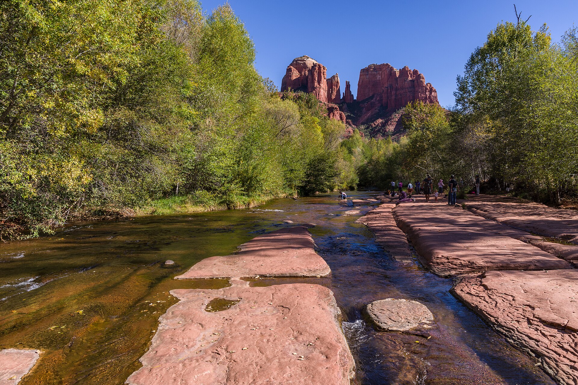
Cathedral Rock in Sedona, seen across Oak Creek
Up north and beyond

Pine country, a drive away


You may hear that northern Arizona is an hour away. It's farther than that, and still well worth the drive. Pine country begins in Payson, at about 5,000 feet, and the air up high is noticeably cooler: in July 2026, Flagstaff's average high was 83.1°F, while Phoenix's was 108.3°F (National Weather Service).

  • Payson and Rim Country: about 1.5 hours from East Mesa
  • Prescott and Sedona: about 2 to 2.5 hours
  • Flagstaff: about 2.5 to 3 hours
  • Grand Canyon South Rim: about 4 to 4.5 hours, a weekend rather than a day trip

Times are without traffic or stops (OpenStreetMap routing, October 14, 2026, matched to official Phoenix-area drive times); add about 15 minutes from Queen Creek for most trips north. Weekend traffic on I-17 and winter snow on SR 87, SR 260 or I-17 can add a lot more, so check AZ511 before you go.

Day trips and weekends, nearest first


Fifteen places worth knowing, from Rim Country to the Grand Canyon. Several had closures after the 2026 Pocket Fire and recent flooding, so I've noted each one as of October 14, 2026.

Gila County · about 1.5 hours

Payson and Rim Country

The nearest pine-forest town to the East Valley, at about 5,000 feet just below the Mogollon Rim, reached by the Beeline Highway (SR 87). The town's tourism site says fall color usually peaks in mid-to-late October and points to the Mogollon Rim, the East Verde River area and the Horton Creek trail, which the Forest Service lists at 4 miles to Horton Spring.

About 74 road miles from East Mesa and 82 from Queen Creek. Afternoon thunderstorms are common from early July to mid-September, and winter storms can bring snow to SR 87 and SR 260.

Town of Payson, Visit Arizona and USDA Forest Service, checked Oct 14, 2026
Below the Rim · about 1.75 hours

Pine and Strawberry

Two small communities on SR 87 north of Payson. The Pine Trailhead is the main starting point for the Highline Trail, about 50 miles below and along the Rim, part of it on the Arizona National Scenic Trail. Strawberry's log schoolhouse dates to about 1885 and was listed on the National Register of Historic Places in 2005.

About 89 to 92 road miles from East Mesa and 97 to 101 from Queen Creek. The Highline is rated difficult. The local historical society runs the schoolhouse, so check its hours before going.

USDA Forest Service, ADOT and Arizona Highways, checked Oct 14, 2026
North of Payson · about 1.75 to 2 hours

Tonto Natural Bridge State Park

Arizona State Parks says the bridge is "believed to be the largest natural travertine bridge in the world." It stands 183 feet high over a 400-foot-long tunnel. A paved path runs along the top, and the Waterfall and Gowan trails lead into the canyon.

About 88 road miles from East Mesa. Open 9 a.m.–5 p.m.; $10 for ages 14 and up, $5 for ages 7–13. Dogs aren't allowed on trails. The Pine Creek and Anna Mae trails and the area under the bridge are closed after flooding.

Arizona State Parks, checked Oct 14, 2026
Apache-Sitgreaves forests · about 2 to 2.25 hours

The Mogollon Rim and Woods Canyon Lake

The Rim is the southwestern edge of the Colorado Plateau, an escarpment about 200 miles long with cliffs up to about 2,000 feet. Woods Canyon Lake is stocked with rainbow and tiger trout and allows only electric motors and paddle craft. A 4-mile trail circles the lake, and the Rim Lake Vista Trail follows the Rim's edge.

About 108 road miles from East Mesa, off SR 260 east of Payson, at about 7,000 to 7,600 feet. The lake's season runs May through November. The Forest Service calls the Rim very lightning-prone, so get off it during storms.

USDA Forest Service, Visit Arizona and Arizona Geological Survey, checked Oct 14, 2026
Yavapai County · about 2 to 2.25 hours

Prescott and the Granite Dells

The City of Prescott gives its average elevation as about 5,400 feet. Watson Lake Park sits among the granite boulders of the Granite Dells, with two boat launches, kayak and canoe rentals, fishing and rock climbing, and downtown's Courthouse Plaza and Whiskey Row are a National Register historic district.

About 125 road miles from East Mesa and 136 from Queen Creek. Swimming isn't allowed at Watson Lake; check the city's website for current parking fees and holiday events.

City of Prescott, checked Oct 14, 2026
Verde Valley · about 2.25 to 2.5 hours

Jerome

A former copper-mining town on Cleopatra Hill, at over 5,000 feet. Claims were first staked in 1875, the town had nearly 15,000 residents in its boom years, and mining ended in 1953. Jerome State Historic Park fills the 1916 Douglas Mansion with mining history and a 3-D model of the town and its mines.

About 137 road miles from East Mesa and an easy pairing with Sedona or Prescott. The park is open 9 a.m.–4:30 p.m.; $10 for ages 14 and up. The streets are steep and winding.

Arizona State Parks and Town of Jerome, checked Oct 14, 2026
Red Rock Country · about 2.25 to 2.5 hours

Sedona and Oak Creek Canyon

Red rock country at about 4,350 to 4,500 feet (Visit Sedona), with trailheads such as Bell Rock, Boynton Canyon and Cathedral Rock. Visit Sedona lists seasonal averages of about 95/73°F in summer and 60/34°F in winter, and fall color in Oak Creek Canyon runs from late October into early November.

About 144 road miles from East Mesa. Many Forest Service trailheads take a Red Rock Pass ($5 a day, $15 a week, $20 a year), and the Sedona Shuttle runs to trailheads Thursday to Sunday with no fare. After the 2026 Pocket Fire, the Forest Service extended its West Fork area closure on September 26, 2026, and it was still in place in mid-October.

Visit Sedona, USDA Forest Service (Coconino National Forest) and Sedona Shuttle, checked Oct 14, 2026
Oak Creek Canyon · about 2.5 hours

Slide Rock State Park

A creekside state park built around a natural rock water slide in Oak Creek, on the former Pendley Homestead, an apple farm Frank Pendley homesteaded in 1910. The historic apple packing shed holds weekend open houses.

About 149 road miles from East Mesa. $20 per vehicle with one to four people from August 22, 2026 through April 2027, plus $5 for each additional person; vehicles only, with no reservations. The swim area is closed for high water, and there's no apple picking this fall.

Arizona State Parks, checked Oct 14, 2026
White Mountains · about 2.75 hours

Show Low and Fool Hollow Lake

A pine-country city at about 6,350 feet. Fool Hollow Lake Recreation Area, a state park at about 6,300 feet among ponderosa pines, has year-round camping, fishing, lakeside hiking and paddle-craft rentals, and the Forest Service lists Rim Road (Forest Road 300) nearby as a fall-color drive.

About 150 road miles from East Mesa and 156 from Queen Creek, through Globe or Payson. Fool Hollow is $10 for a vehicle with one person or $20 with two to four. Low water means hand-launched boats only for now.

City of Show Low, Arizona State Parks and USDA Forest Service, checked Oct 14, 2026
Flagstaff · about 2.75 to 3 hours

Lowell Observatory and dark skies

Clyde Tombaugh discovered Pluto at Lowell Observatory in February 1930, and visitors can see the Pluto Discovery Telescope dome and look through telescopes after sunset. The City of Flagstaff became the world's first International Dark Sky City on October 24, 2001.

About 171 road miles from East Mesa and 183 from Queen Creek. Lowell is open noon–10 p.m., Wednesday through Monday; check its website for admission. The campus sits at 7,250 feet, so dress in layers.

Lowell Observatory and City of Flagstaff, checked Oct 14, 2026
East of Flagstaff · about 2.75 hours

Walnut Canyon National Monument

Cliff dwellings built more than 700 years ago by the people archaeologists call the Sinagua. The paved Island Trail is a 1-mile round trip with many stairs, dropping 185 vertical feet past 25 cliff-dwelling rooms, and the National Park Service rates it strenuous for visitors not used to the 7,000-foot altitude.

About 180 road miles from East Mesa. Open 9 a.m.–5 p.m.; $25 per private vehicle, valid one to seven days. Trails may close for snow or ice in winter.

National Park Service, checked Oct 14, 2026
Near Tucson · about 3 hours

Mount Lemmon

The Catalina Highway climbs about 27 miles from the desert near Tucson to forest above 9,000 feet, and the summit is 9,157 feet. Summerhaven, near the top, has cabins, a general store and restaurants, and the Forest Service calls Mount Lemmon Ski Valley the southernmost ski area in the continental United States.

About 143 road miles from Queen Creek and 149 from East Mesa, a little closer from Queen Creek. Several Forest Service sites along the highway need a recreation pass. Ski runs usually operate mid-December to early April, snow permitting.

USDA Forest Service (Coronado National Forest), checked Oct 14, 2026
San Francisco Peaks · about 3 hours

Arizona Snowbowl

Snowbowl's gondola tops out at 11,500 feet, which the resort calls the highest lift-served point in Arizona. The 2026/27 ski season is scheduled to open November 20, 2026, weather permitting, and scenic gondola rides run in summer and fall.

About 184 road miles from East Mesa and 196 from Queen Creek. The fall-color gondola season runs through October 18, 2026. Snowbowl Road gets heavy traffic on fall-color and snow days, and lift prices vary by date.

Arizona Snowbowl and Discover Flagstaff, checked Oct 14, 2026
White Mountains · about 4 hours

Sunrise Park Resort

A ski area owned and run by the White Mountain Apache Tribe, with winter skiing and snowboarding, and summer weekends (Friday to Sunday) of zip lining, mountain biking, scenic lift rides and the Apache Alpine Coaster. The resort says it's within a 4-hour drive of Phoenix.

About 192 road miles from East Mesa and 198 from Queen Creek. No 2026/27 opening date had been announced.

Sunrise Park Resort, checked Oct 14, 2026
Coconino County · about 4 to 4.5 hours

Grand Canyon, South Rim

Open all year, with the South and Desert View entrances open 24 hours. The South Rim averages about 7,000 feet, the canyon averages a mile deep, and the park counted 4,430,653 visits in 2025. Only select areas of the North Rim reopened for 2026, after the 2025 Dragon Bravo Fire destroyed the Grand Canyon Lodge.

About 255 road miles from East Mesa and 267 from Queen Creek, so plan a weekend. $35 per private vehicle, valid seven days; entrance stations take cards only. The North Kaibab Trail and Phantom Ranch have been closed since flash flooding on August 29, 2026.

National Park Service, checked Oct 14, 2026

The high country, season by season

  • Fall: color often starts in late September. Flagstaff's aspens are usually at their peak in early October, Payson's color in mid-to-late October, and Oak Creek Canyon's can last into November. The road to Lockett Meadow near Flagstaff (Forest Road 552) has been closed for maintenance since July 14, 2026.
  • Winter: Flagstaff averages 90.1 inches of snow between October and May, and snow can affect SR 87, SR 260, I-17 and park trails. Check AZ511 before every winter drive.
  • Summer: the high country is where the cooler air is, about 25 degrees cooler than the Valley in July 2026. Monsoon storms bring afternoon lightning to the Rim, so start hikes early.
USDA Forest Service (Coconino National Forest), Town of Payson, Discover Flagstaff and National Weather Service, checked Oct 14, 2026

Getting around

Freeways, airports and the light rail

Most East Valley trips begin on surface roads laid out on a one-mile grid, then join one of five freeways. Public transit is limited out toward Queen Creek and East Mesa, so plan on driving, and test any commute at rush hour before you choose a home.

East Valley freeways and the light rail
RouteWhere it goesGood to know
Loop 202 (Red Mountain, SanTan and South Mountain freeways)A loop of about 78 miles in all. The SanTan Freeway runs from I-10 in Chandler east through Gilbert to US 60 in Mesa, and the Red Mountain Freeway continues north and west to I-10 in Phoenix; the South Mountain Freeway links I-10 in Chandler to west Phoenix.Near Mesa Gateway Airport, the Hawes Road and Power Road exits serve the airport.
SR 24 (Gateway Freeway)About 5.5 miles east from Loop 202 near Eastmark to Ironwood Drive, along the north edge of the Queen Creek areaEast of Ellsworth Road it still has traffic signals. ADOT plans to widen it into a full freeway with interchanges at the cross streets; check ADOT for current timing.
US 60 (Superstition Freeway)From I-10 in Tempe east through Mesa to Apache Junction, then on as a highway through Gold Canyon toward Superior and GlobeThe route to the Superstitions, Boyce Thompson Arboretum, Roosevelt Lake and the White Mountains
Loop 101 and I-10Loop 101 runs through Tempe and Chandler; I-10 links them with Sky Harbor, downtown Phoenix and TucsonADOT has finished rebuilding I-10's 11-mile Broadway Curve. Downtown Tucson is about 103 road miles, about 2 hours, from Queen Creek Town Hall.
Valley Metro light railFrom its eastern end at Gilbert Road and Main Street in Mesa, with a park-and-ride, west through downtown Mesa and Tempe to PhoenixThe eastern end opened May 18, 2019. Trains stop across the street from Mesa Arts Center and run to downtown Phoenix for games and concerts.

Sources: ADOT and Wikipedia route histories, checked Oct 14, 2026. Construction schedules shift, so treat any dates as planned, not final. Check az511.gov for closures.

Southeast Mesa · about 12 minutes from Queen Creek

Mesa Gateway Airport (AZA)

On the former Williams Air Force Base, and renamed from Phoenix-Mesa Gateway in December 2024. It carried about 2.04 million passengers in 2025, a record. Allegiant is the main carrier, and Sun Country flies to Minneapolis–St. Paul.

About 6 road miles from Queen Creek Town Hall and 8 (about 15 minutes) from Eastmark, since the terminal is on the west side of the airfield. Many Allegiant routes are seasonal or run a few days a week, so check current schedules.

City of Mesa (Dec 2024), KTAR (Jan 2026) and Mesa Gateway Airport, checked Oct 14, 2026
Phoenix · about 45 to 50 minutes

Phoenix Sky Harbor (PHX)

Sky Harbor served more than 51.6 million passengers in 2025. Its media kit lists 24 commercial airlines flying to more than 130 domestic and 24 international destinations from Terminals 3 and 4.

About 35 road miles from Queen Creek Town Hall (about 50 minutes) and 31 from Eastmark (about 45 minutes), without traffic. Allow extra time at weekday rush hour on Loop 202, US 60 and I-10.

Phoenix Sky Harbor media kit and OpenStreetMap routing, checked Oct 14, 2026

A new chapter

Moving to a new state is a big new chapter, a little scary and very exciting. I'd be glad to walk with you through both, one detail at a time.


Brittany Fanelli, REALTOR®|Real Broker

Shopping, dining & entertainment

Farm tables, downtowns and spring training

From Queen Creek's own shopping centers and farm destinations to historic downtowns, ballparks and theaters. Drive times are from Queen Creek Town Hall and from Eastmark in East Mesa, without traffic.

Shopping centers


Queen Creek · about 1 mile from Town Hall

Queen Creek Marketplace

A Vestar center of about 900,000 square feet at Rittenhouse Road and Ellsworth Loop Road, with Target, Kohl's, Trader Joe's and Harkins Theatres. Nordstrom Rack opened a store here on May 16, 2024.

About 6 road miles (12 minutes) from Eastmark. Tenants change, so check Vestar's directory before you go.

KTAR (May 2024) and Vestar, checked Oct 14, 2026
Queen Creek · new and opening

Queen Creek's newer centers

Queen Creek Crossing, at Ellsworth Road and Fulton Parkway, is anchored by Costco, with Hobby Lobby and BJ's Restaurant and Brewhouse. A 145,000-square-foot Target opened at Vineyard Towne Center, at Gantzel and Combs roads, in October 2025, alongside Sprouts. The Switchyard, a 10-acre project in the Town Center, has announced Snooze, Shake Shack, Postino and Bamboo Sushi.

All within a few miles of Queen Creek Town Hall. The Switchyard is still under construction, with restaurants expected by the end of 2026.

KTAR, Hoodline (Jan 2026) and AZFamily (Mar 2026), checked Oct 14, 2026
Gilbert · about 18 minutes

SanTan Village

An open-air shopping, dining and entertainment center at Loop 202 and Williams Field Road. Its website names Dillard's, Macy's and Nordstrom Rack among its major retailers, along with Apple, lululemon and HomeGoods, a 16-screen Harkins theater, and restaurants including The Keg, Kona Grill and Shake Shack.

About 9 road miles from Queen Creek Town Hall and 10 from Eastmark. Open 10 a.m.–8 p.m. Monday through Thursday, 10 a.m.–9 p.m. Friday and Saturday, and 11 a.m.–6 p.m. Sunday; store hours vary.

SanTan Village, checked Oct 14, 2026
Mesa · about 18 to 23 minutes

Superstition Springs Center

An enclosed regional mall of about 1.2 million square feet beside US 60 at Power Road, open since 1990. Its website lists Dillard's, JCPenney, Ross, T.J. Maxx and Ulta Beauty.

About 13 road miles from Queen Creek Town Hall and 10 from Eastmark. Open 10 a.m.–8 p.m. Monday through Saturday and 11 a.m.–6 p.m. Sunday.

Superstition Springs Center, checked Oct 14, 2026
Chandler · about 31 minutes

Chandler Fashion Center

More than 180 retailers, with Dillard's, Macy's and Scheels as the large stores, plus Harkins Theatres and Round1 Bowling & Arcade. Its directory also lists Seafood City Supermarket, the chain's first Arizona store.

About 19 road miles from Queen Creek Town Hall and 21 from Eastmark.

Chandler Fashion Center, checked Oct 14, 2026
Mesa · Tempe · about 35 to 42 minutes

Mesa Riverview and Tempe Marketplace

Mesa Riverview, next to Sloan Park, has a 170,000-square-foot Bass Pro Shops and a Cinemark theater. Tempe Marketplace, at the Loop 101 and Loop 202 interchange, is an open-air center of about 1.3 million square feet with more than 100 shops and restaurants, fire pits and water features, and more than 300 events a year.

Mesa Riverview is about 27 road miles from Queen Creek Town Hall and 23 from Eastmark; Tempe Marketplace about 29 and 25.

Bass Pro Shops and Tempe Marketplace, checked Oct 14, 2026

Downtowns and local food


Queen Creek · about 10 minutes

Queen Creek Olive Mill

A family-run olive farm and mill; owners Perry and Brenda Rea moved to Arizona in 1997. Visitors can take the daily Olive Oil 101 class and the Estate Train Tour, eat breakfast, lunch or dinner in the dining room, and shop for its olive oils and vinegars.

About 4.6 road miles from Queen Creek Town Hall and 9 from Eastmark. Check the mill's website for current hours and event dates before you go.

Queen Creek Olive Mill and Visit Arizona, checked Oct 14, 2026
Queen Creek · about 13 minutes

Schnepf Farms

A working farm with a bakery, country store, café and coffee shop, a U-pick organic garden, and a farm park with a petting zoo, jumping pillows, a ropes course and train rides. The Pumpkin & Chili Party runs through October 31, and the farm says it's in its 30th year.

About 5 road miles from Queen Creek Town Hall and 12 from Eastmark. The bakery, store and café are open Thursday through Sunday, 8 a.m.–4 p.m. Check the farm's website for holiday-season dates, which weren't posted yet.

Schnepf Farms, checked Oct 14, 2026
Gilbert · about 14 to 18 minutes

Agritopia: Joe's Farm Grill and Barnone

Joe's Farm Grill is in the Johnston family's 1966 ranch-style house and cooks with produce from The Farm at Agritopia, about 12 acres of urban farmland farmed since 1927. Next door, Barnone fills a converted barn with 12 West Brewing, the Garage-East winery, Fire and Brimstone pizza and Cream of the Crop desserts.

About 9.5 road miles from Queen Creek Town Hall and 7 from Eastmark, at Higley and Ray roads. Joe's Farm Grill is open daily, 7:30 a.m.–9 p.m.

Joe's Farm Grill and Discover Gilbert, checked Oct 14, 2026
Gilbert · about 24 to 29 minutes

Downtown Gilbert

Gilbert began turning its historic downtown buildings into restaurants and gathering places in the early 1990s. Discover Gilbert describes more than 30 restaurants with open-air patios in the Heritage District, along with Water Tower Plaza, with its color-lit 1927 water tower and a splash pad, murals, a theater and the Gilbert Historical Museum.

About 15 road miles from Queen Creek Town Hall and 13 from Eastmark. Two parking garages, surface lots and street parking have no parking charge. Weekend evenings are busy.

Discover Gilbert, checked Oct 14, 2026
Chandler · about 27 minutes

Downtown Chandler

The historic core around Dr. A.J. Chandler Park, the original town square, lined with restaurants, shops, galleries and the historic San Marcos hotel, with events on the Downtown Stage. The city's 2022 downtown overview counted more than 45 bars and restaurants, mostly along Arizona Avenue.

About 15.5 road miles from Queen Creek Town Hall and 17 from Eastmark. The Tumbleweed Tree Lighting and Parade of Lights is Saturday, December 5, 2026, 4:30–9 p.m.

City of Chandler, checked Oct 14, 2026
Mesa · about 30 to 35 minutes

Downtown Mesa

Main Street has local restaurants, breweries within a short walk of each other, public art and Mesa Arts Center, with the light rail running down the middle. Merry Main Street brings holiday events downtown each season.

About 23 road miles from Queen Creek Town Hall and 19 from Eastmark. Parking near Mesa Arts Center can be limited during large shows.

Downtown Mesa Association and City of Mesa, checked Oct 14, 2026

Games, arts and events


Mesa · Cactus League

Spring training

The Chicago Cubs train at Sloan Park, a City of Mesa ballpark that opened in 2014 and seats about 15,000, and the Athletics at Hohokam Stadium, with about 10,500 seats. In 2027, the A's open on Friday, February 19 at Hohokam against the Cubs, and the Cubs' home opener is Saturday, February 20 against Cincinnati.

Sloan Park is about 28 road miles from Queen Creek Town Hall and 24 from Eastmark. The Cactus League has 15 teams at 10 ballparks.

Cactus League and City of Mesa, checked Oct 14, 2026
Downtown Mesa · about 30 to 35 minutes

Mesa Arts Center

Four theaters, from the 1,570-seat Ikeda Theater to the 99-seat Farnsworth Studio Theater, plus the Mesa Contemporary Arts Museum and studios for art classes. Programming includes touring Broadway shows, concerts, dance and cultural events.

About 23 road miles from Queen Creek Town Hall and 19 from Eastmark. The box office is open Tuesday through Saturday, noon–5 p.m., and the light rail stops across the street.

Mesa Arts Center, checked Oct 14, 2026
Gold Canyon · about 28 to 36 minutes

Arizona Renaissance Festival

An open-air Renaissance village called Fairhaven, with jousting, falconry, games and rides, food and an artisan market. The 2027 season runs Saturdays and Sundays from February 6 through April 4, 2027.

About 18 road miles from Eastmark and 24 from Queen Creek Town Hall, via US 60. Tickets are listed at $39 for adults and $25 for ages 5–12, plus tax and fees; ages 4 and under get in at no charge.

Arizona Renaissance Festival, checked Oct 14, 2026
Phoenix and Glendale · about 47 to 72 minutes

Pro sports

The Suns and Mercury play at Mortgage Matchup Center in downtown Phoenix (formerly Footprint Center, renamed in October 2025), which hosts the 2027 NBA All-Star Game. The Diamondbacks play at Chase Field downtown, the Cardinals at State Farm Stadium in Glendale, and Phoenix Rising FC near Sky Harbor.

Downtown Phoenix is about 38 road miles from Queen Creek Town Hall and 35 from Eastmark; State Farm Stadium about 55 and 52. The light rail runs from Mesa's Gilbert Road park-and-ride to downtown Phoenix.

AZFamily (Oct 2025) and KTAR, checked Oct 14, 2026
Mesa · year-round, busiest October to April

Golf

Dobson Ranch is the City of Mesa's 18-hole, par-72 municipal course, with a lighted driving range and PGA instruction. Visit Mesa's golf guide also lists the daily-fee Superstition Springs Golf Club and Longbow Golf Club, and the semi-private Las Sendas Golf Club in northeast Mesa.

Superstition Springs Golf Club is about 13 road miles from Queen Creek Town Hall and 10 from Eastmark. Call each course for rates and tee times.

City of Mesa and Visit Mesa, checked Oct 14, 2026
Holiday season 2026

Community celebrations

Chandler's Tumbleweed Tree Lighting and Parade of Lights is Saturday, December 5, 2026, in downtown Chandler. Mesa's Merry Main Street, Gilbert's Water Tower holiday lighting and Queen Creek's Hometown Christmas round out the season.

I couldn't confirm 2026 dates for the Mesa, Gilbert and Queen Creek events, so check with each city or town before you go.

City of Chandler, checked Oct 14, 2026
Living with the seasons

Four seasons, desert style


Average highs and lows at Phoenix Sky Harbor (NOAA 1991–2020 normals), with what each season tends to bring.

01

Winter · December to February

Highs of about 66 to 71°F and lows of about 45 to 49°F. The official station averages fewer than one freezing night a year and a trace of snow, with some winter rain. It's trail, patio and golf season, and snow is a drive up north.

02

Spring · March to May

Highs climb from about 78°F in March to 94.5°F in May, and the average first 100°F day is May 2 (NWS Phoenix). Spring training, festival weekends and the last of the prime hiking months.

03

Summer · June to September

Highs of about 100 to 107°F with warm nights of about 78 to 85°F. Monsoon season runs June 15 to September 30 (NWS), and storms usually start around early July. Mornings outside, afternoons in the shade, and weekends up north or on the water.

04

Fall · October and November

Highs ease from about 89°F in October to 76.5°F in November, and the average last 100°F day is October 5. Pumpkin season at the farms, fall color in the high country and holiday lights by late November.

Summer heat in practice

How summer really works

Summer here is manageable with a little planning. These are the official safety tips, plus the details I check on every home so you're ready for July.

Heat safety

  • Drink water before you feel thirsty, and wear light, loose clothing and a wide-brimmed hat.
  • Use air conditioning. Maricopa County notes that once temperatures pass 95°F, fans alone aren't enough.
  • Never leave children or pets in a parked car, and check on neighbors who live alone.
  • Get care for cramps, confusion, vomiting or no longer sweating.

The county's 2026 Heat Relief Network ran May 1 to September 30 with more than 200 cooling and hydration sites; dial 2-1-1 to find one. The National Weather Service now calls its top heat alert an Extreme Heat Warning.

Maricopa County Public Health and NWS, checked Oct 14, 2026

Monsoon season

  • Expect lightning, high winds, dust storms and flash flooding between June 15 and September 30.
  • In a dust storm, "Pull Aside, Stay Alive": pull off the road, turn your lights off and take your foot off the brake.
  • "Turn Around, Don't Drown": never drive into a flooded road or wash.
National Weather Service and City of Phoenix, checked Oct 14, 2026

At home

  • Schedule an HVAC check before summer, and budget for July power bills, not January's.
  • I ask for 12 months of utility bills for every home we consider, so you're working from real numbers.
  • Pool homes come with Arizona's pool barrier law and a state pool safety notice; more on that in the practical side below.

My Relocation Kit includes a summer budget worksheet.

The practical side

The details, made simple

County lines, schools, utilities, taxes and the MVD. Each one is worth confirming for a specific address, and I'm glad to do that with you.

Maricopa or Pinal County


Mesa, Gilbert and Chandler are in Maricopa County. San Tan Valley is in Pinal County and became its own town on September 17, 2025, Arizona's 92nd municipality. Queen Creek is in both: about 74,600 people live in its Maricopa County part and about 15,200 in its Pinal County part (U.S. Census Bureau, July 2025).

The county decides who assesses a home and sends its property tax bill, and a "Queen Creek" mailing address doesn't guarantee a home is inside town limits. I check the parcel record for every home. More in my Queen Creek guide

Sources: U.S. Census Bureau Vintage 2025; Pinal County (Sept 2025).

School districts, by name


Boundaries follow the address, not the city line, so I check the assigned schools with the district for every home.

  • Queen Creek: Queen Creek Unified, Higley Unified and Chandler Unified in the Maricopa portion; Florence and J.O. Combs Unified in the Pinal portion
  • San Tan Valley: J.O. Combs Unified and Florence Unified
  • East Mesa: Mesa Public Schools, Gilbert Public Schools and Queen Creek Unified, which runs Eastmark High School, plus Higley Unified in a small area
  • Gilbert: Gilbert Public Schools and Higley Unified, plus Chandler Unified in parts
  • Chandler: Chandler Unified and Kyrene

Arizona's open enrollment (A.R.S. 15-816.01) lets students apply to schools outside their boundary when space allows. District names from district sites and my area guides, checked Oct 2026.

See state letter grades for districts near Queen Creek and East Mesa

Electricity and gas


Salt River Project (SRP) provides electricity to most East Valley addresses, and Arizona Public Service (APS) serves some areas; the City of Mesa runs its own electric utility in about 5.5 square miles around downtown. The City of Mesa also supplies natural gas across much of Mesa and, through its Magma system, parts of Queen Creek and San Tan Valley, and Southwest Gas serves other areas. Many newer homes are all-electric.

Arizona homes averaged $160.24 a month for electricity in 2024, compared with $142.26 nationally (U.S. Energy Information Administration). Summer bills run well above the average, so I look at the actual bills for each home.

Sources: SRP, Town of Gilbert, City of Mesa and U.S. EIA, checked Oct 14, 2026.

Water, explained


Water comes from the city, the town or a private utility, depending on the address; EPCOR, for example, took over the former Johnson Utilities area in 2021. Hard water is normal here (city FAQs list Chandler at an average of 16.5 grains per gallon and Mesa at 12 to 22 by zone), so water softeners are common.

In Arizona's Active Management Areas, new subdivisions must show a 100-year assured water supply. Since June 2023, the Arizona Department of Water Resources hasn't approved new groundwater-only certificates in the Phoenix area; other water sources still qualify, and existing homes aren't affected.

Sources: City of Chandler, City of Mesa, EPCOR and ADWR, checked Oct 14, 2026.

Taxes


Arizona's state income tax is a flat 2.5% for tax year 2023 and later (Arizona Department of Revenue, as of 2026). Property taxes run roughly 0.4% of home value: Census figures for 2024 show a median of $1,916 in property taxes on a median home value of $482,800 in Maricopa County, and $1,556 on $381,200 in Pinal County.

Some newer communities add Community Facilities District (CFD) or other special district taxes, so I pull the actual tax bill for every home we consider.

Sources: Arizona Department of Revenue; U.S. Census Bureau, American Community Survey 2024. General information only, not tax advice.

Your car and the MVD


ADOT says to register a vehicle brought from another state as soon as you become an Arizona resident, which includes working here, registering to vote or staying 7 or more months in a year. You'll surrender the out-of-state title and registration, and some Phoenix-area vehicles need an emissions test first. If your paperwork isn't complete, a $15, 90-day resident registration is available.

Plan to get an Arizona driver license once you establish residency, and check ADOT for the current rules. ADOT also recommends setting up an AZ MVD Now account.

Sources: ADOT Motor Vehicle Division and myAZcar.com, checked Oct 14, 2026.

Clocks that never change


Most of Arizona stays on Mountain Standard Time all year; the Navajo Nation, in northeastern Arizona, does observe daylight saving time. In practice, East Valley clocks never change, so we match Pacific time in summer and Mountain time in winter.

Sources: U.S. Department of Transportation and NIST, checked Oct 14, 2026.

Pools and HOAs


Arizona's pool barrier law (A.R.S. 36-1681) applies where a child under six lives: the pool must be fully enclosed by a barrier at least 5 feet high, with self-closing, self-latching gates that open outward. Anyone selling, renting or building a pool home must give the buyer or renter the state's pool safety notice, and cities can be stricter.

Most newer master-planned communities have an HOA, sometimes two. When a home in an HOA sells, Arizona law (A.R.S. 33-1806) requires the governing documents, rules and a statement of assessments within 10 days of notice of the sale, and I read them with you.

Sources: Arizona Revised Statutes and Arizona Department of Health Services, checked Oct 14, 2026.

Work nearby


Intel's Ocotillo chip-making campus is in Chandler. The City of Mesa lists Mesa Public Schools (7,829 Mesa-based employees), Banner Health (6,468), the City of Mesa (5,250) and Boeing (4,600), which builds the AH-64 Apache helicopter at Falcon Field, among its largest employers.

Banner Health describes itself as Arizona's largest private employer, and Banner Ironwood Medical Center serves Queen Creek and San Tan Valley. In Queen Creek, LG Energy Solution is building a $5.5 billion battery manufacturing complex.

Sources: City of Mesa (2023–25 data), Banner Health and Town of Queen Creek, checked Oct 14, 2026.

Explore further


My area guides go deeper on the market, communities and county lines, and my buyer pages walk through every step.

School district grades


Every year, the State of Arizona gives each public school an A–F letter grade, based mostly on state test results, plus graduation and college and career readiness for high schools. In the 2024–25 grades, the newest available, 188 of the 210 graded schools in the eight districts serving Queen Creek, East Mesa and nearby areas earned an A or a B.

Grades are one measure of a school, and they can't capture everything you may care about. I'd encourage you to visit the schools you're considering, and I confirm the assigned schools with the district for every home we look at.

See the grades for each district, with report cards and boundary maps Source: Arizona Department of Education, AZ School Report Cards (2024–25, released October 2025), checked Oct 14, 2026. Counts cover Queen Creek Unified, Gilbert Public Schools, Higley Unified, Mesa Public Schools, Chandler Unified, J.O. Combs Unified, Florence Unified and Apache Junction Unified.
Buying from out of state

Moving from afar, step by step


  1. Listing alerts before you visit

    Tell me your areas, budget and must-haves, and I'll set up a custom listing alert by hand, so you can follow the market from wherever you are now.

  2. An in-person consultation

    Once you know your travel dates, we'll plan a relaxed, sit-down consultation for your first visit. I meet every new client in person, and it's where your list becomes a plan.

  3. A focused tour plan

    Before you arrive, I group the homes and communities worth seeing by area and check each one's county, school district, HOA and tax bill, so your time here goes to the right places. If new builds are on your list, I'll handle builder registration, since many builders require your agent from the very first visit.

  4. A written buyer agreement

    Before we tour homes together, we sign a written buyer agreement, and I explain every line of it first.

In the meantime, questions are always welcome by phone, text or email: 480.628.1128 or homes@brittanyfanelli.com. I reply to every message personally during office hours.

The East Valley Relocation Kit

Settle in with confidence

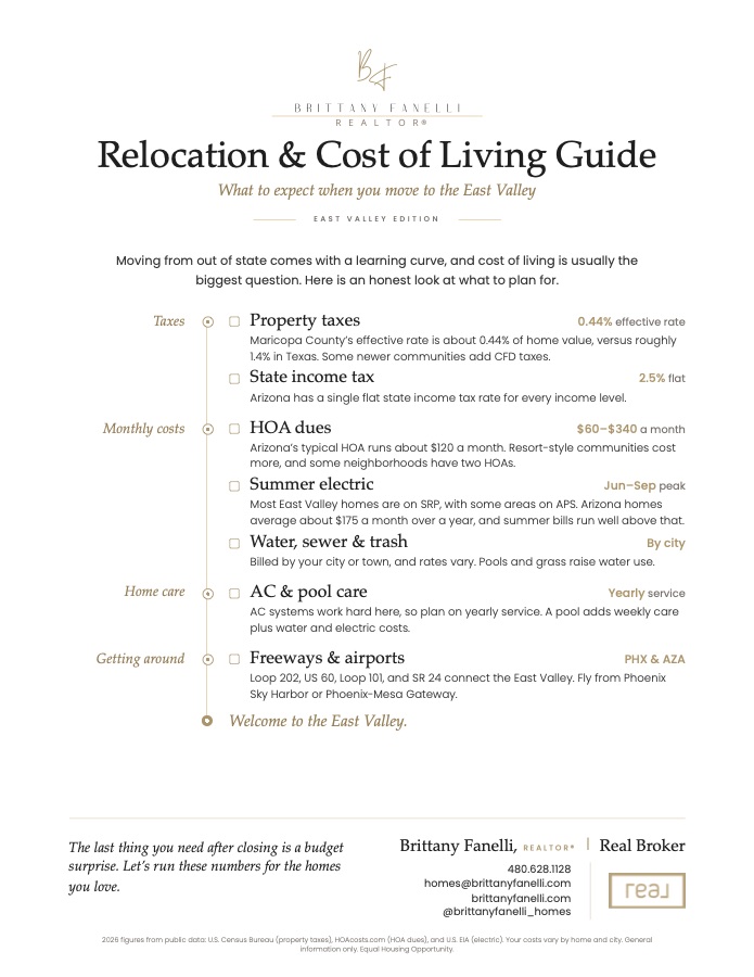
My Relocation Kit pairs the Relocation & Cost of Living Guide with Trusted Local Resources, so you can plan the costs and your first-month to-do list before the moving truck arrives.

First page of the Relocation and Cost of Living Guide, covering taxes, monthly costs and getting around the East Valley
Cost of living & settling in

East Valley Relocation Kit

An honest look at what it costs to live in the East Valley, written for a move from out of state, with a summer budget worksheet (budget for July, not January) and a first-month checklist. Trusted Local Resources adds a page for your lender, inspector, utilities and home-care team, and I'm glad to share names I trust in any category.

What's inside

  • Property, CFD and state income taxes, explained
  • HOA dues, summer electric and water costs
  • The freeways and the two nearby airports
  • A summer budget worksheet and a first-month checklist
  • Arizona basics: monsoon season, hard water, no daylight saving time
  • Trusted Local Resources, by category

Get the Relocation Kit

The Relocation & Cost of Living Guide and Trusted Local Resources open right away.

Your guide opens right away, and I'll follow up personally. I never sell your information or share it for anyone else's marketing. Privacy

Relocation FAQ

Questions about moving here

How hot does it really get in the East Valley?

Hot, and for a long stretch. At Phoenix Sky Harbor, the official Valley weather station, July averages a high of 106.5°F and a low of 84.5°F, and about 111 days a year reach 100°F or more (NOAA 1991–2020 normals). The average first 100°F day is May 2 and the average last is October 5 (NWS Phoenix). Winters are the trade: January averages a high of 67.6°F. Summer life runs on early mornings, shade, air conditioning and a summer utility budget.

When is a good time to visit for house hunting?

Homes come on the market all year, so the right time is whenever your plans allow. October through April is the most comfortable time to explore neighborhoods and trails. A summer visit has its own value: you'll feel the heat, see how a home's shade and air conditioning handle it, and know what July really means. Either way, I'll plan the tour around your dates.

How far are the mountains and the cooler weather?

The desert mountains are close: San Tan Mountain Regional Park is about 7.5 road miles from Queen Creek Town Hall, and Usery Mountain Regional Park about 7 from East Mesa. Pine country is farther than people often think: Payson is about 1.5 hours away, Prescott and Sedona about 2 to 2.5 hours, Flagstaff about 2.5 to 3 hours, and the Grand Canyon's South Rim about 4 to 4.5 hours. Those are estimates without traffic (OpenStreetMap routing, October 2026).

Is the East Valley in Maricopa or Pinal County?

It depends on the address. Mesa, Gilbert and Chandler are in Maricopa County, and San Tan Valley is in Pinal County. Queen Creek is in both, mostly Maricopa, with about 15,200 of its 89,770 residents in its Pinal County part (U.S. Census Bureau, July 2025). The county sets who assesses your home and sends the tax bill, and a mailing address doesn't settle it, so I check the parcel record for every home.

When do I need to register my car in Arizona?

ADOT says to register a vehicle from another state as soon as you become an Arizona resident, for example when you start working here or register to vote. Some Phoenix-area vehicles need an emissions test first, and a $15, 90-day resident registration is available if your paperwork isn't complete. For your driver license, check ADOT's current rules once you've established residency.

Which school districts serve Queen Creek and East Mesa?

Several, and boundaries follow the address. In Queen Creek's Maricopa County portion, most homes are in Queen Creek Unified, with some in Higley and Chandler Unified; the Pinal County portion is served by Florence and J.O. Combs Unified. East Mesa is served by Mesa Public Schools, Gilbert Public Schools and Queen Creek Unified, plus Higley Unified in a small area. I check the assigned schools with the district for every home, and Arizona's open enrollment lets students apply elsewhere when space allows.

Do most East Valley homes have an HOA?

Most newer master-planned communities do, sometimes with both a master association and a neighborhood one, and some add Community Facilities District taxes to the property tax bill. Homes without an HOA come on the market too. Before you write an offer, I read the CC&Rs, budget and resale disclosure with you, so you know the dues, any special assessments and the rules that matter to you.

Can you help while I'm still living out of state?

Yes. I'll set up a custom listing alert so you can follow the market from home, answer your questions by phone, text or email, and plan your first visit around an in-person consultation and a focused tour. Before we tour homes together, we'll sign a written buyer agreement, and I'll explain every line of it first.

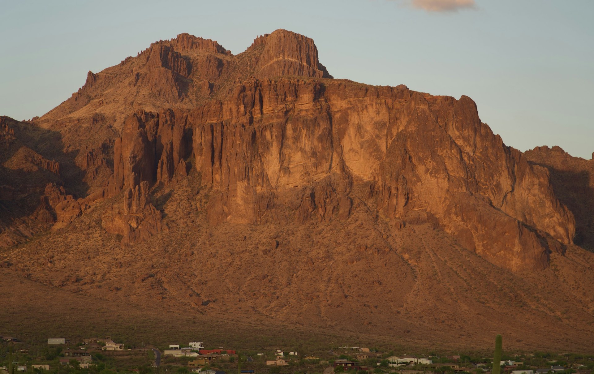
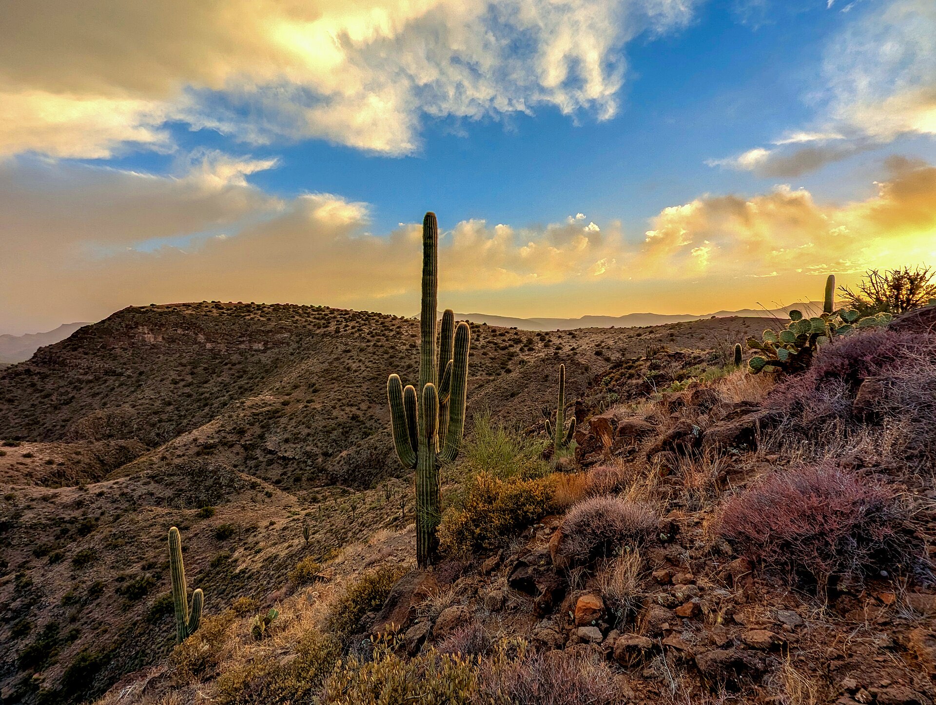
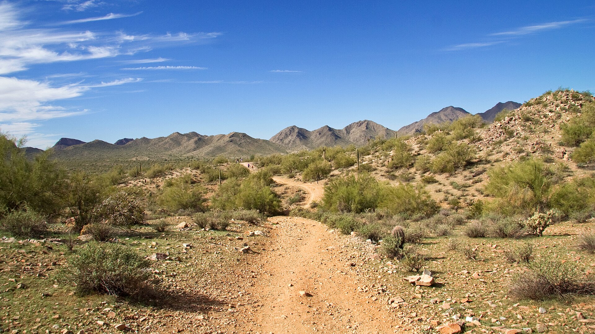
Scenery photos: Superstition Mountains by Daniel Applegate on Unsplash; saguaros at sunset by Ralph Burrillo, Bureau of Land Management Arizona; San Tan Mountain Regional Park trail by ksblack99 (public domain); the lake view is my own photo; Cathedral Rock in Sedona by Deborah Lee Soltesz, U.S. Forest Service. Scenery photos are not listings.

Whenever you're ready

Let's talk about your next chapter.


A relaxed, sit-down consultation, in person. No pressure and no obligation. Bring your questions, and I'll bring a plan.

Brittany Fanelli, REALTOR®|Real Broker